From Sky to Soil: Young Agricultural Leaders Nourish FAS Satellite Data with Grassroots Truth
Accurate crop mapping is a crucial process to informing reliable crop production estimates, addressing climate change, and developing strategies for sustainable agriculture. U.S. Department of Agriculture’s Foreign Agricultural Service is working with university students in Tanzania on a pilot project to gather grassroots data on grain, oilseed, and cotton crops to help strengthen community agricultural systems and improve crop condition assessments with satellite imagery. Their field work is adding truth from the ground up to the sky.
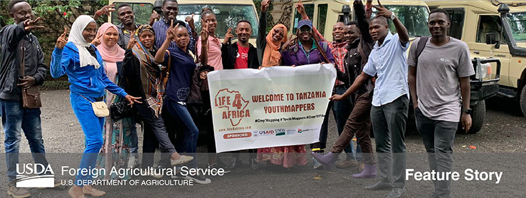
In April, 14 YouthMappers spent four days in the Arusha area capturing data on 334 fields by photographing, georeferencing, and identifying target crops to enhance FAS satellite imagery analysis. YouthMappers is an international network of university-based chapters that organize and implement mapping activities in response to global and local development needs.
Please click here to read more >> |